Eagle LiDAR Scanner
57,990.00 DH
Sur Commande
Description
–section-background-hash: 0;
}
#shopify-section-template–16800454246469__rich_text_4JBPfk + * {
–previous-section-background-hash: 0;
}
#shopify-section-template–16800454246469__rich_text_4JBPfk {
–rich-text-max-width: 780px
}
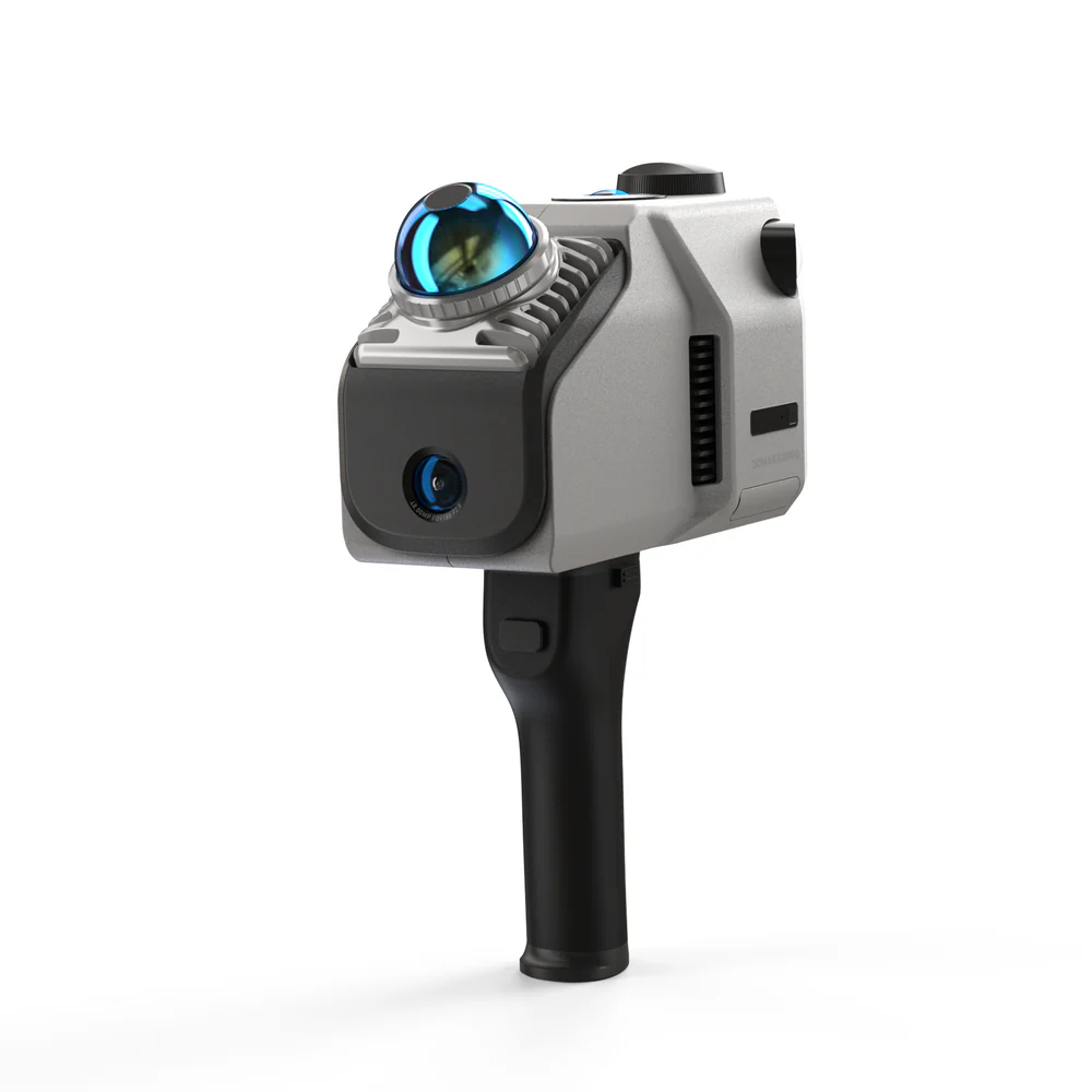
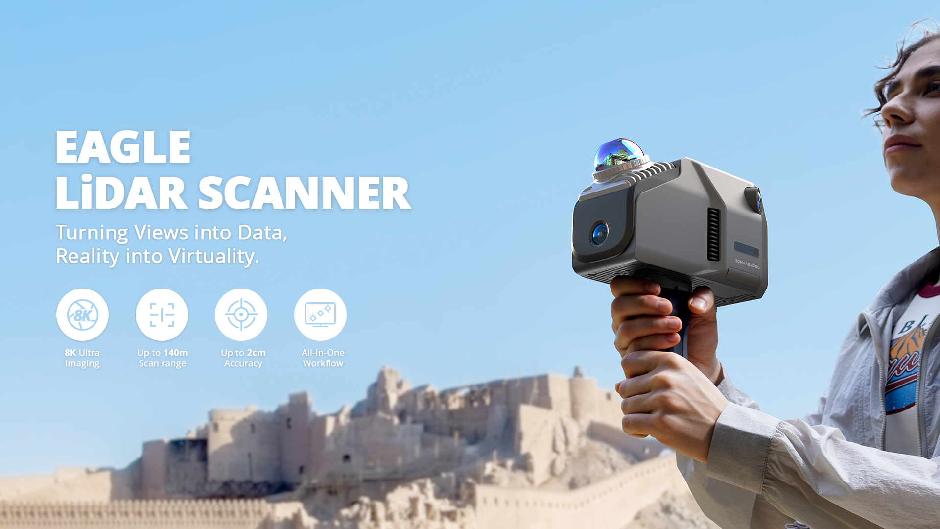
Introducing 3DMakerpro Eagle
Eagle is 3DMakerpro’s high-performance spatial scanner, combining high precision, wide coverage, and user-friendly operation. Designed for professionals seeking efficiency and accuracy, Eagle offers an end-to-end solution from data acquisition to 3D production, enabling large-scale 3D scene modeling within minutes. Whether for architectural surveying, film production, or virtual exhibitions, Eagle streamlines the entire process into a one-stop experience.
–section-background-hash: 001062010050121030090382270940200;
}
#shopify-section-template–16800454246469__rich_text_bR7bUN + * {
–previous-section-background-hash: 001062010050121030090382270940200;
}
#shopify-section-template–16800454246469__rich_text_bR7bUN {
–rich-text-max-width: 780px
}
–section-background-hash: 0;
}
#shopify-section-template–16800454246469__multi_column_6Mjmd9 + * {
–previous-section-background-hash: 0;
}
#shopify-section-template–16800454246469__multi_column_6Mjmd9 {
–multi-column-grid: none;
–multi-column-list-gap: var(–spacing-12);
}
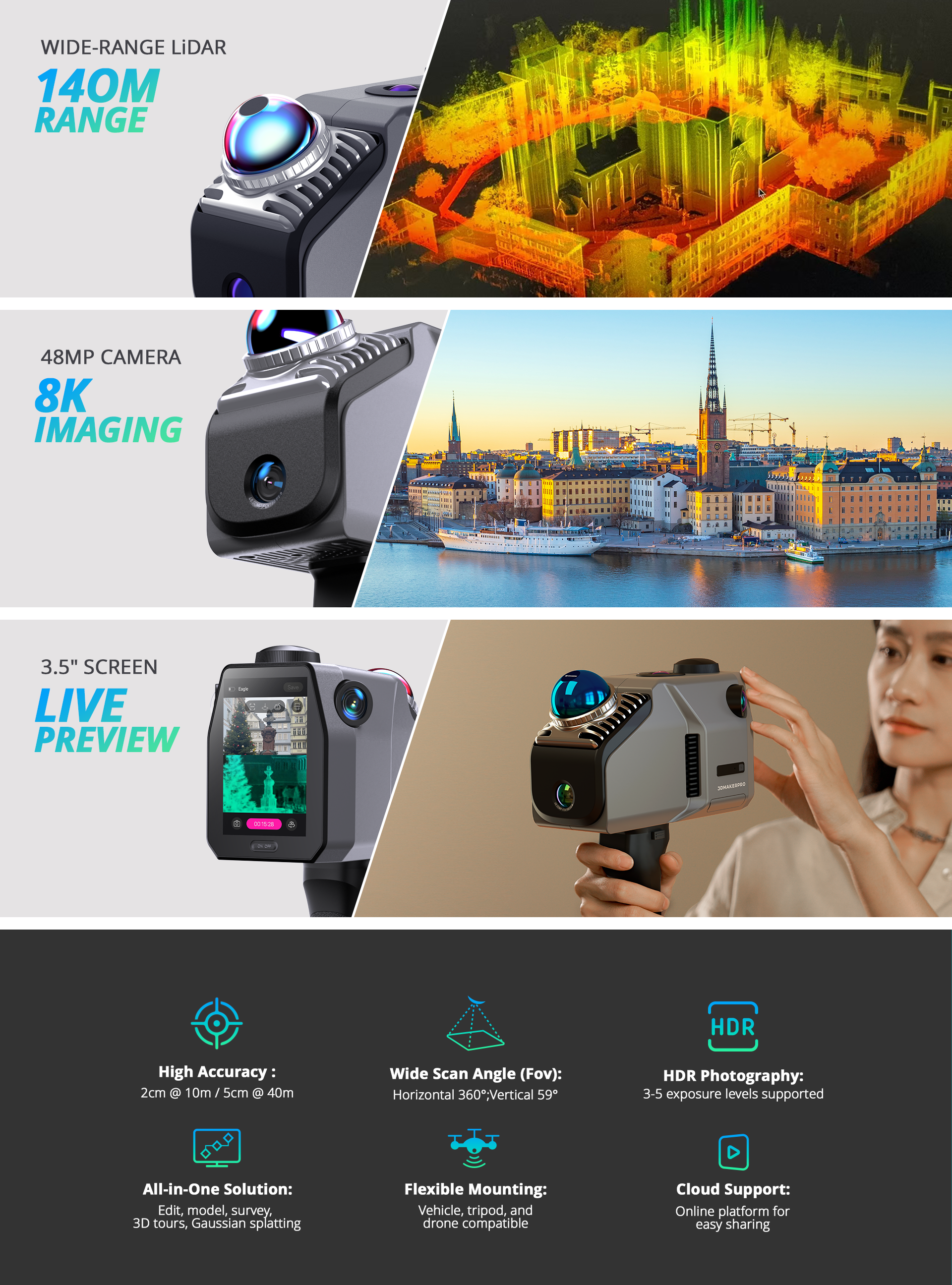
Ready to Use
No complex calibration is required, saving up to 50% of preparation time compared to traditional devices.
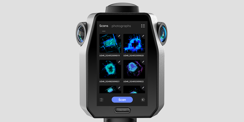
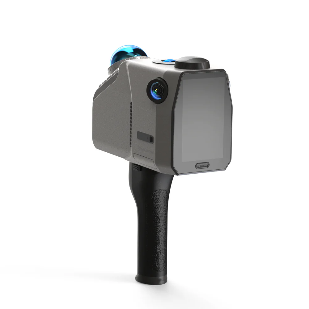
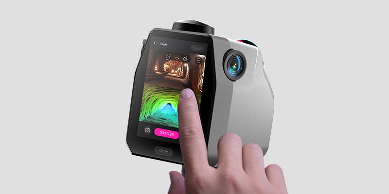
On-Site Review Operations
Equipped with a 3.5-inch screen, Eagle offers three real-time display modes during data collection: point cloud, photos, or split-screen point cloud/photos. After collection, users can instantly review point cloud projects, GPS trajectories, and photos.
–section-background-hash: 0;
}
#shopify-section-template–16800454246469__rich_text_TWgVrN + * {
–previous-section-background-hash: 0;
}
#shopify-section-template–16800454246469__rich_text_TWgVrN {
–rich-text-max-width: 780px
}
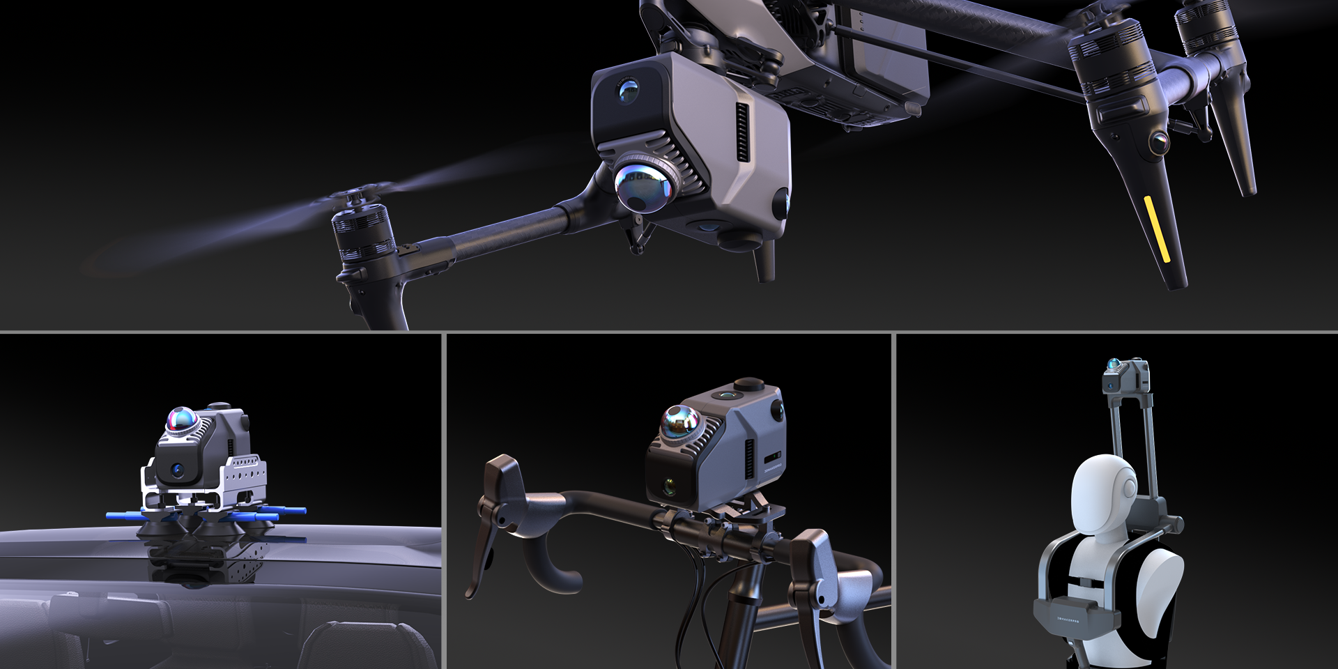
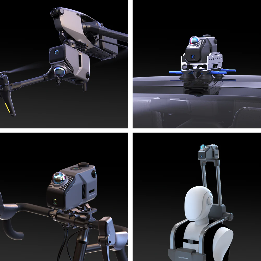
Adaptable to Various Platforms and Vehicles
Eagle collects up to 200,000 points per second, maintaining data quality even at speeds of 20km/h, meeting the needs of dynamic operations across various vehicles.
–section-background-hash: 001062010050121030090382270940200;
}
#shopify-section-template–16800454246469__rich_text_pFPUd4 + * {
–previous-section-background-hash: 001062010050121030090382270940200;
}
#shopify-section-template–16800454246469__rich_text_pFPUd4 {
–rich-text-max-width: 100%
}
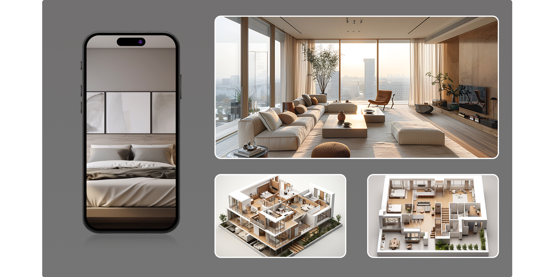
Platform and Software
Whether it’s architectural surveying, film production, or virtual exhibitions, Eagle’s workflow and companion software ensure a seamless experience from point cloud capture to final presentation.
Produits similaires
-
Creality CR-Scan 01 3D Scanner Upgraded Combo
12,999.00 DHFuture Product
Ajouter au panierFuture Product
-
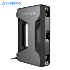
EinScan Pro 2X Plus 3D Scanner
86,990.00 DHFuture Product
Ajouter au panierFuture Product
-
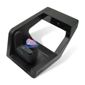
Desktop Lab Scanner
43,990.00 DHEn stock
Ajouter au panierEn stock
-
Creality – CR-Scan Raptor
14,999.00 DHEn stock
Ajouter au panierEn stock